Thank you for your fine cooperation.
We got up early Sunday morning as it was another packed day. The group split into two, with one group heading to Hallasan, the Volcano mountain on the island, and those not wanting to hike it staying with the bus. The guides had said several times the previous day that the hike was long and hard and that anyone unsure if they were up to it should stay with the bus. It's about a 18km hike, and they told us it would be about 8 hours. As we all had a plane to catch, we really couldn't run over time. In the end, about three quarters of the group tackled the mountain, while the rest saw more museums and sites around the island.
Now, Bukhansan on Wednesday was not an easy climb at times, and I figured an 8 hour hike as steep as that would be rough, so I asked the one guide if mount Halla was as steep as Bukhan. He said it was a steep hike, just a long one. I now really want to know what his definition of steep is, because if Hallasan wasn't steep, than a steep mountain must be practically vertical.


The rock slopes and the rock steps


Occasionally with wood beam support

And every so often an boardwalk on the flat portions. Though they too we often rock paths.
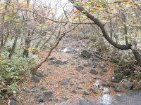
It was a rough hike, I have to say. The climb up was tiring, especially as we were doing it quite quickly to keep on schedule. Most of the route up was a path of rocks, which got to be a tad hard on the ankles. The big issue though were the crazy rock pseudo-stairs that they had. They were uneven and we were essentially scrambling up a rock slide at times. There was the occasional boardwalk, but for the most part the route was all rocks until the last little bit. We couldn't see the top for most of the hike, and when we finally broke through the treeline, we saw the peak and a line of hikers going up the stairs.


Our first view of the peak and the stair pilgrimage. (you should click on the left image to see the people)
We ate the lunch we had carried at the top and took some pictures of the now grass-filled crater and its pond. The wind was intense, and it got very cold up there. One Korean man laughed a little when he saw my fiancee holding her chopsticks with her sleeve-wrapped hand. We couldn't stay up there long due to the cold, so we started down. Down was certainly less tiring than up, but still difficult, as we had to step carefully down the steep rocks or, you know, fall to our deaths or something. It also seemed much longer, probably because we were pretty tired. But route we took down was certainly easier than up, and also more scenic as we went down into the valley between two peaks, back up the other peak, and down into a valley again. Unfortunately my camera battery was dying, so I didn't get quite as many shots as I wanted.
It was an amazing hike. Tiring, but amazing. I'm not sure if I'd ever do this hike a second time, but it's definitely something I'm glad I've done once.
When we got to the end, we sat and relaxed for a little bit waiting for the bus and the rest of the group. A few hikers had found the hike really tough and were about half and hour behind us with the one guide who brought up the rear. They came in, so did the bus, and we were off.
The bus group had gone around the island during the day including Mini World (a park with miniature models of world sites), a green tea farm, and the sex museum, which has many odd sex-related sculptures. Jeju also sports a Teddybear museum with displays of famous events, people, and art, rendered with Teddybears. Here are a few pictures, but I didn't see them myself.
On the way to the airport, we stopped by the Mysterious Road, and section of road with a slight decline, but an optical illusion giving it an incline. The guide explained that we were at the top of the hill, but that if we looked forward, it seemed like we were at the bottom. The one girl, who I had found rather annoying during the trip, clearly didn't understand what he was explaining, as her response to his statement that the road looked like it went uphill was, "That's because we're at the bottom of it," in a rather arrogant tone. The driver put the bus into neutral and we rolled up / down the hill. After getting out of the bus, my fiancee and I figured out the illusion. The ditches running beside the road get deeper as the road goes up. Thus the fences along the ditches, as well as the row of trees, descend relative to the road. Thus, from the top of the road, the rising fences and tree rows gives the upward appearance. A point for us.
We got to the airport and the guide gave us his last, "Thank you for your fine cooperation," a phrase he had used constantly over the course of the trip and more and more jokingly as he realised that we came to expect it after each stop of the bus. I highly recommend both Adventure Korea, and Jeju Island.


No comments:
Post a Comment